|
The nuclear fuel chain destroys the environment and kills from the start, with uranium mining, to the finish, with long-lived, deadly, nuclear waste. Why does the US government refuse to protect America’s National Forests and water supply? Why does it fail to uphold its obligations to the American Indians?Especially at the behest of foreign mining companies? Why must Americans fight foreign companies in court, and even fight Congressmen, to protect the land and water?

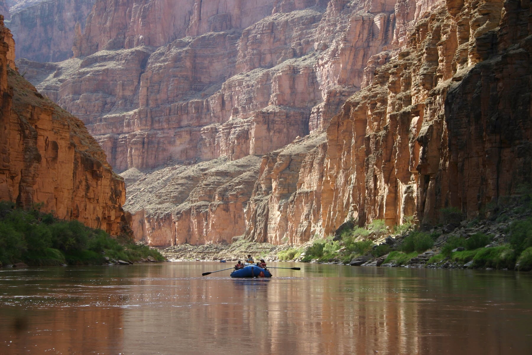
Boating down the Colorado River Below Havasu Creek in Grand Canyon National Part, by Mark Lellouch, NPS

Grand Canyon, National Park Service (NPS)
Press Release from the Center for Biological Diversity: “April 8, 2015
Federal Judge OKs Uranium Mining Next to Grand Canyon National Park
Decision Allows Mining Without Tribal Consultation or Update Decades-old Environmental Review
PHOENIX, Ariz.— U.S. District Court Judge David Campbell denied a request to halt new uranium mining at the Canyon uranium mine, located only six miles from Grand Canyon National Park’s South Rim. The Havasupai tribe and a coalition of conservation groups had challenged the U.S. Forest Service’s decision to allow Energy Fuels Inc. to reopen the mine without initiating or completing formal tribal consultations and without updating an obsolete federal environmental review dating to 1986. At stake are tribal cultural values, wildlife and endangered species, and the risk of toxic uranium mining waste contaminating the aquifers and streams that sustain the Grand Canyon and Colorado River.
“We are very disappointed with the ruling by Judge Campbell in the Canyon Mine case,” said Havasupai Chairman Rex Tilousi. “We believe that the National Historic Preservation Act requires the Forest Service to consult with us and the other affiliated tribes before they let the mining company damage Red Butte, one of our most sacred traditional cultural properties. The Havasupai Tribal Council will meet this week to talk about appealing this ruling.”
The decision fails to protect “Red Butte Traditional Cultural Property,” which the Forest Service designated in 2010 for its critical religious and cultural importance to several tribes, especially Havasupai. As a “traditional cultural property,” Red Butte is eligible for inclusion on the National Register of Historic Places. The Havasupai tribe and conservation groups argued that the Forest Service violated the National Historic Preservation Act by failing to consult with tribes to determine how the adverse impacts of the Canyon Mine on Red Butte could be avoided or mitigated prior to approving mining.
“This is bad news for protecting Grand Canyon and tribal sacred sites,” said Roger Clark of the Grand Canyon Trust. “Over the last two decades, we’ve learned how uranium mining can pollute aquifers that feed canyon springs and Havasu Falls. But the Forest Service has ignored that information and failed to require Energy Fuels to take reasonable steps to prevent contamination of water, sacred sites and public lands.”
The Forest Service first approved the Canyon mining plan in 1986, despite a challenge from the Havasupai tribe. Uranium prices plummeted shortly thereafter and the mine closed in 1990 before producing any uranium. The Forest Service allowed the Canyon Mine to reopen in 2012 without a plan update or environmental assessment to reflect the extensive changed circumstances since the original review and approval. These changes include the 2010 designation of the Red Butte traditional cultural property, reintroduction of the endangered California condor in the vicinity of the Canyon Mine, and the 2012 decision to ban new uranium mining across 1 million acres near the Grand Canyon.
“This uranium project could haunt the Grand Canyon region for decades to come,” said Katie Davis with the Center for Biological Diversity. “Uranium mining leaves a highly toxic legacy that endangers human health, wildlife and the streams and aquifers that feed the Grand Canyon. It’s disappointing to see the Forest Service prioritizing the extraction industry over the long-term protection of a place as iconic as the Grand Canyon.”
“We will continue to fight to protect Grand Canyon, its waters and its watershed,” said Sandy Bahr, director of Sierra Club’s Grand Canyon Chapter.“The Forest Service should consider the harm this mine could cause to the groundwater and ultimately the waters in Grand Canyon National Park. We are extremely disappointed in the judge’s failure to recognize that.”
Geologists have warned that uranium mining could deplete and contaminate aquifers that discharge into Grand Canyon and that cleaning them up would be next to impossible. A 2010 U.S. Geological Survey study found elevated uranium levels in soil and water sources associated with past uranium mining. Groundwater connectivity studies of the Grand Canyon that were published subsequent to the Canyon Mine’s 1986 approval indicate the potential for uranium contamination to infiltrate perched and deep aquifers and regional creeks and springs, including Havasu Falls. Energy Fuels plans to start mining uranium at the Canyon Mine in mid-June of 2015.
Plaintiffs in the suit include the Havasupai tribe, Grand Canyon Trust, Center for Biological Diversity and Sierra Club. The coalition has 60 days to appeal Judge Campbell’s decision to the 9th Circuit Court of Appeals.
Background
The Canyon Mine is located on the Kaibab National Forest six miles south of Grand Canyon National Park. The mine’s original approval in 1986 was the subject of protests and lawsuits by the Havasupai tribe and others objecting to potential uranium mining impacts on regional groundwater, springs, creeks, ecosystems and cultural values associated with Red Butte. Aboveground infrastructure was built in the early 1990s, but a crash in uranium prices caused the mine’s closure in 1992 before the shaft or ore bodies could be excavated. Pre-mining exploratory drilling drained groundwater beneath the mine site, eliminating an estimated 1.3 million gallons per year from the region’s springs that are fed by groundwater.
A 2010 U.S. Geological Survey report noted that past samples of groundwater beneath the mine exhibited dissolved uranium concentrations in excess of EPA drinking water standards. Groundwater threatened by the mine feeds municipal wells and seeps and springs in Grand Canyon, including Havasu Springs and Havasu Creek. Aquifer Protection Permits issued for the mine by Arizona Department of Environmental Quality do not require monitoring of deep aquifers and do not include remediation plans or bonding to correct deep aquifer contamination. Originally owned by Energy Fuels Nuclear, the mine was purchased by Denison Mines in 1997 and by Energy Fuels Resources Inc., which currently operates the mine, in 2012.
The judge’s decision can be found here.” http://www.biologicaldiversity.org/programs/public_lands/mining/Grand_Canyon_Uranium_Mining/pdfs/Canyon_Mine_Decision.pdf
Press release and more info found here: http://www.biologicaldiversity.org/news/press_releases/2015/uranium-mining-04-08-2015.html (Emphasis our own)
 “Red Butte is a distinct knob located on the Coconino Plateau south of Grand Canyon National Park. The summit of Red Butte and the fire lookout tower are reached by a short but relatively steep 1.25 mile trail, one way. The Red Butte Trail climbs from 6,460 ft. (1970M) elevation at the trailhead to 7,326 ft. (2233M) elevation on top of Red Butte. For the first .75 mile, the trail climbs moderately and has only a few switchbacks. The last .5 mile ascends the steep, upper slopes of the butte and has several switchbacks and steep grades. The trail is well-marked and easy to follow. Caution should be taken in the summer months when rattlesnakes may be present on or along the trail. “Red Butte is a distinct knob located on the Coconino Plateau south of Grand Canyon National Park. The summit of Red Butte and the fire lookout tower are reached by a short but relatively steep 1.25 mile trail, one way. The Red Butte Trail climbs from 6,460 ft. (1970M) elevation at the trailhead to 7,326 ft. (2233M) elevation on top of Red Butte. For the first .75 mile, the trail climbs moderately and has only a few switchbacks. The last .5 mile ascends the steep, upper slopes of the butte and has several switchbacks and steep grades. The trail is well-marked and easy to follow. Caution should be taken in the summer months when rattlesnakes may be present on or along the trail.
Red Butte, a prominent topographic feature on the Coconino Plateau, is a lava-capped remnant of overlying rock layers that have been eroded from the surrounding area. For much of the Tusayan Ranger District, the rock layer on the surface is the Paleozoic Era Kaibab Limestone. The Kaibab Limestone is also found along the rim of the Grand Canyon. A marine limestone approximately 270 million years old, it records an ancient tropical ocean environment. Red Butte is the only locale in which the layers from the Mesozoic Era and Cenozoic Era can be viewed for quite some distance. The base of the butte is comprised of red sandstones and siltstones of the approximately 240 million year-old Moenkopi Formation. These rocks were once sand and mud in tropical tidal flats. Above this layer are conglomerates, rocks with fragments and grains of many sizes, in the Shinarump Member of the Chinle Formation. The Shinarump Member was deposited about 225 million years ago as sands and pebbles in river channels. These two rock layers are capped by a basalt, or iron-rich volcanic rock, which has been dated as about 8.5 to 9 million years old. This basalt cap is the only remnant of an ancient lava flow that once covered the area.”
http://www.fs.usda.gov/recarea/kaibab/recreation/outdoorlearning/recarea/?recid=11684&actid=119 Discusses 2010 traditional cultural designation: http://www.fs.usda.gov/Internet/FSE_DOCUMENTS/stelprdb5297268.pdf
|